Colorado Jeep & 4WD
Buena Vista Jeeping & ATV/UTV Trails
Not all towns appear on map. The publisher does not assume any responsibility for accuracy or completeness of maps. This information was compiled as accurately as possible.
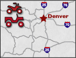
Buena Vista is located approximately 2 hours southwest of Denver, ideal for a one day trip. The area, recognized as the Fourmile Travel Management Area, provides access to all types of outdoor recreation. With widely varying terrain open to ATV's and 4x4's and year-round accessibility, imagination is the only boundary.
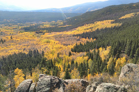
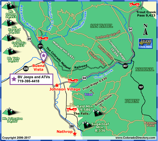
Mining history abounds in Colorado and Buena Vista is no exception. Arnold Gulch Road provides access to the Triad & Bald Mountain Silver mines, rendered useless after silver crashed in the 1890's, south of US 24. On the north side is the old railroad grade that originally serviced The Colorado Midland Railroad. The line transported Freight, coal and passengers between Colorado Springs and New Castle (near Glenwood Springs). Lenhardy Cut-off, north of US 24, served mail route access and revenue as a toll-road. Off shoots of this trail include McGee Gulch, Shields Gulch, and Limestone ridge. Last but certainly not least, Fourmile Travel Management Area is known for its view of the 14,000' Collegiate Peaks:
- Mt. Columbia: 14,073'
- Mt. Harvard: 14,420'
- Mt. Oxford: 14,153'
- Mt. Princeton: 14,197'
- Mt. Yale: 14,196'
Places to Stay & Fun Things to Do
Serving Salida and Royal Gorge: Jeep rentals and trail maps. Anderson will get you off the beaten path to play in the Collegiate Peaks. Guided Jeep Tours: Discover private mines, rock hounding claims.
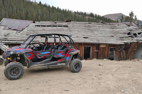
Buena Vista = Mountain Back-Country Adventure! A true Colorado Experience: ride a Jeep or ATV have a fantastic time getting to our highest peaks, see ghost towns, wildlife. Rentals: Hourly, half-day, full-day.
More Activities & Information
Buena Vista Area, Colorado includes: Johnson Village, Nathrop, St. Elmo
Jeep & 4WD in Colorado